Sapa Local Guides · Vietnam · August 2026
Fansipan, Vietnam — Sapa's Highest Peak: Trekking, Cable Car & Visitor Guide
What Is Fansipan?
Fansipan is the highest mountain in Vietnam, rising 3,143 metres above sea level in the Hoang Lien Son range of Lao Cai Province. Its summit sits above the cloud line for much of the year, looking down across a maze of forested ridges, deep valleys, and — on clear days — the terraced landscapes of Muong Hoa Valley far below.
For travelers arriving in Sapa, Fansipan is both a landmark and a question. Some come specifically to stand on the roof of Indochina. Others see it every morning as mist peels back from the peaks above town, then spend their days walking through villages rather than climbing toward the summit. Both approaches are valid — but they require different planning, fitness levels, and expectations about weather.
Fansipan is not a single viewpoint you tick off between café stops. It is a high-altitude massif with its own microclimate, ecology, and cultural significance to the Black Hmong and Red Dao communities who farm and forage on its lower slopes. Understanding the mountain helps you decide whether to ride the cable car, attempt a multi-day ascent, or simply appreciate it as the backdrop to a valley trek — the model most guests of Sapa Local Guides follow.
For wider trip context — when to visit, how to reach Sapa, homestays, trek choice, budget, and packing — start with The Complete Sapa Travel Guide, How to Get from Hanoi to Sapa, How Many Days Do You Need in Sapa, and What to Pack for Sapa.
Geography and Elevation
Fansipan dominates the skyline west of Sapa Town, which itself sits at roughly 1,500 metres on the eastern rim of the massif. From town, the peak appears close — almost touchable on crisp mornings — but the summit is still nearly 1,600 vertical metres higher, across broken ridgelines, cloud forest, and exposed rock.
The mountain forms part of the Hoang Lien Son range, a northeast–southwest spine on Vietnam's border with Yunnan, China. Geologically, it is young and steep: deep erosion has carved the valleys that ethnic minority communities now farm, while the highest summits retain harsh, sub-alpine conditions unusual for this latitude.
Elevation changes everything in Sapa. A warm afternoon in town can coincide with near-freezing wind chill near the summit. Rain falling on terrace paths in Muong Hoa may appear as fog at mid-elevation and sleet higher up. Mountain weather on Fansipan is not a forecast detail — it is the primary factor governing safety, visibility, and whether a summit attempt is worth attempting on a given day.
Tram Ton Pass — often described as the highest mountain pass in Vietnam — lies on the road between Sapa and Lai Chau, cutting through the Hoang Lien range at around 1,900 metres. It is a useful geographic reference: the pass shows how quickly the landscape rises once you leave the Sapa basin, and how the Hoang Lien Mountains form a climatic barrier between the Red River valley and the northwest highlands.
The Hoang Lien Mountains
The Hoang Lien Mountains — Hoang Lien Son in Vietnamese — are the broader range of which Fansipan is the highest point. They extend beyond what most Sapa visitors see on a single valley day hike, connecting high forest, isolated hamlets, and ridges that receive a fraction of the foot traffic found in Muong Hoa.
This range matters because Sapa trekking is not only about terraces. Multi-day routes such as the Remote Sapa Trekking Expedition and the 3-Day Sapa Valley & Village Trek gradually expose travelers to higher, quieter sections of the Hoang Lien landscape — forest paths above Sin Chai, long ridge walks, and viewpoints that place Fansipan in context without requiring a summit bid.
Hoang Lien National Park, established to protect the range's biodiversity, covers a large part of the massif surrounding Fansipan. Regulations, trail access, and guided requirements can change; independent trekkers and commercial operators alike should confirm current rules before planning off-path routes. Sapa Local Guides focuses on village-to-village trekking and homestay routes rather than operating Fansipan summit packages — but the mountain remains the geographic anchor for understanding where those trails sit in the wider landscape.
If your goal is to understand the valley beneath the peak rather than climb it, the dedicated guide to Muong Hoa Valley explains the villages, terraces, and ethnic communities that spread across Fansipan's eastern flanks.
History and Cultural Significance
Fansipan predates tourism by millennia. Archaeological and oral histories across northwest Vietnam reflect long occupation by Tai, Hmong, and Dao-speaking peoples who moved through these mountains as farmers, traders, and forest gatherers. For local communities, high peaks are not merely scenery — they mark watersheds, seasonal grazing boundaries, and in many traditions, spiritual presence in the landscape.
French colonial administrators developed Sapa Town in the early twentieth century as a hill station, drawn by cool climate and mountain views. Fansipan appeared on early maps and expedition accounts as the obvious summit goal — though infrastructure was minimal compared with today's cable car era. The town's stone church, colonial villas, and market streets reflect that period; the peak above remained arduous to reach.
Modern tourism transformed access. Where climbers once needed two or three days on the mountain, a cable car and funicular system now lifts visitors toward the summit zone in hours. That shift created tension familiar across mountain destinations: economic opportunity and mass access on one side, environmental pressure and cultural distance on the other.
Black Hmong and Red Dao families living on lower Hoang Lien slopes interact daily with mountain tourism — as guides, porters, homestay hosts, and artisans — even when their own work remains tied to farming and forest products rather than summit conquests. Respect on the mountain begins with respecting those communities in the valleys: asking before photographing, buying crafts directly from makers, and choosing small-footprint private tours when booking treks below the peak.
Trekking to Fansipan
Summiting Fansipan on foot is a serious undertaking — historically a two- to three-day mountaineering route through cloud forest and steep terrain, now sometimes attempted as a very long single-day push by fit, acclimatised hikers. The trail network and permitted access evolve; guided expeditions through approved operators remain the practical option for most visitors who want to climb rather than ride.
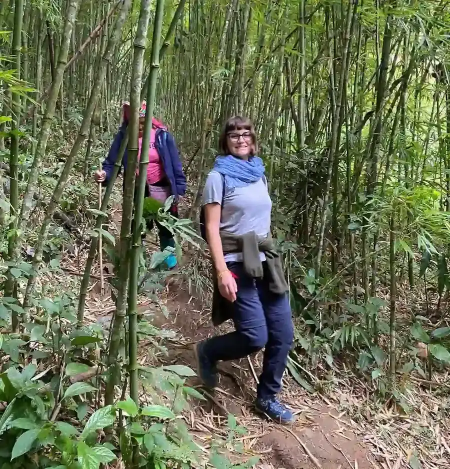
What Sapa Local Guides offers is different but geographically related: private trekking through Hoang Lien foothills and valleys, with local English-speaking guides who grew up in these mountains. These routes are not Fansipan summit tours. They are village treks, homestay journeys, and remote ridge walks that share the same range but focus on human landscape rather than peak bagging.
How commercial Sapa treks relate to Fansipan
- •The [Full-Day Muong Hoa Valley Trek](/sapa-trekking-tours/sapa-trekking-adventure) stays in terrace country well below the summit, but clear weather can frame Fansipan on the skyline during ridge approaches
- •The [3-Day Sapa Valley & Village Trek](/sapa-trekking-tours/3-day-sapa-mountain-trek) moves deeper through multiple valleys over three days — a better match for travelers who want mountain immersion without alpine climbing risk
- •The [Remote Sapa Trekking Expedition](/sapa-trekking-tours/remote-sapa-trek) explores high ridges and isolated hamlets near the Hoang Lien range, including Black Hmong country around Sin Chai and Red Dao villages — the cultural and ecological world Fansipan towers above
If a summit attempt is your primary goal, research current Fansipan climbing regulations and specialist operators separately. If your goal is to understand the mountains through walking, meals in wooden homes, and trails used by local families, browse Sapa Trekking Tours or discuss a custom route through Private Sapa Expeditions.
The Cable Car Experience
Since opening, the Sun World Fansipan Legend cable car has become the most common way visitors reach the summit zone. The system rises from the Muong Hoa Valley floor near Sapa, climbing dramatically over forested slopes to a station complex near the peak. A funicular segment may complete the final approach depending on configuration and weather.
The cable car answers accessibility in a way trekking cannot. Older travelers, families with limited time, and visitors who want a summit photograph without multi-day commitment use it routinely. On clear days, views span the Hoang Lien range and beyond; in cloud, the ride itself becomes a passage through fog forest with brief windows of vertical cliff and canopy.
It also changes the summit atmosphere. The top station area includes viewing platforms, amenities, and significant crowding at peak holiday periods. The experience is part tourism infrastructure, part mountain — plan expectations accordingly.
The cable car is operated independently of Sapa Local Guides trekking products. Tickets, hours, and weather closures are managed by the resort operator; check current schedules before planning a summit day alongside a guided valley trek. Many travelers combine one valley walking day with one cable car morning — a sensible split if you want both cultural depth and a high-altitude panorama.
Viewpoints on lower trekking routes — including some cultural walks around Sapa Town — occasionally overlook sections of the Fansipan cable line above Muong Hoa. Those moments connect the peak visually to the valley routes described in the Muong Hoa Valley guide.
Weather and Seasons on Fansipan
Mountain weather on Fansipan is more extreme than in Sapa Town. Summit conditions can include high wind, chill, fog, and rapid temperature drops even when the valley feels mild.
Spring (March–May)
Often clearer than summer, with recovering visibility after winter mist. Valley trekking is comfortable; summit attempts have a reasonable chance of views, though cold rain still possible.
Summer (June–August)
Warm in Sapa Town, wet across the massif. Cloud wraps the peak frequently; trails are slick. Green forest, but lower summit visibility. Valley treks remain popular with waterproof gear.
Autumn (September–November)
Many locals consider this the best balance — clearer skies, crisp air, golden rice in Muong Hoa below, and improved odds of seeing Fansipan from ridges and summit platforms.
Winter (November–February)
Cold, mist, and occasional frost at elevation. Summit wind chill can be severe. Dramatic atmosphere for photography, but bring serious layers if ascending.
Always check same-day conditions rather than relying on town-level forecasts. Guides working valley routes make safety calls daily; summit operators may suspend cable car service in high wind or electrical storms.
Flora and Fauna
Hoang Lien National Park protects one of Vietnam's most significant high-altitude ecosystems. Lower slopes mix subtropical forest with cleared terrace agriculture. Mid-elevations hold mossy cloud forest where orchids, rhododendrons, and ferns thrive in persistent humidity. Higher zones transition toward stunted trees, bamboo, and exposed granite near the summit.
Wildlife is present but rarely seen on busy routes — gibbons, civets, and numerous bird species inhabit the range, along with smaller mammals and rich insect life. Ethnic minority communities traditionally forage medicinal plants and forest products on regulated lower slopes; Red Dao herbal knowledge, visible on homestay routes, connects directly to this ecology.
Fansipan's biological value is one reason off-trail wandering and litter on the massif matter. Stick to marked paths on independent walks, pack out waste, and treat water sources upstream of villages with care.
Photography on Fansipan
From the summit and cable car
Clear mornings offer the broadest panoramas. Midday cloud build-up is common in warmer months. Sunset and sunrise slots can be crowded at the summit station but rewarding in stable weather.
From Sapa Town and valley routes
Fansipan often appears as a backdrop above cloud inversions — town viewpoints and upper terrace paths can frame the peak without ascending. Telephoto compression from Muong Hoa ridges can stack the summit above layered terraces on clear autumn days.
Practical tips
Cold drains batteries quickly near the summit; carry spares warm against body heat. Lens fog is common transitioning from cable car to outdoor platforms — allow acclimatisation time. Drones may face restrictions near the national park and resort infrastructure; confirm locally before flying.
Respect people over peak selfies: valley photography involving villagers always requires permission, whether Fansipan is in frame or not.
Visiting Fansipan Responsibly
High mountains with easy cable access attract volume. Responsible visiting reduces pressure on forest trails, summit infrastructure, and communities below.
- •Do not litter on trails or summit platforms — pack out everything carried up
- •Stay on marked paths in national park zones; avoid damaging fragile alpine vegetation
- •Respect summit staff and local guides; their weather calls are safety decisions
- •In valleys, apply the same ethics as any Sapa trek: ask before photographing, buy directly from artisans, and choose private low-impact tours where possible
- •Do not treat ethnic minority villages as staging areas for summit content without engaging respectfully with residents
Sapa Local Guides operates private treks with a minimum of two paying travellers, working directly with families in Hoang Lien foothills. That model spreads economic benefit toward village homestays and local guides rather than concentrating entirely on mass summit traffic — a useful complement if Fansipan is one part of a longer Sapa stay rather than your only destination.
Practical Visitor Information
Where Fansipan sits relative to Sapa Town
Sapa Town lies on the eastern side of the Hoang Lien massif. Fansipan summit is west–northwest of town, above Muong Hoa Valley and the cable car base area. Most Sapa Local Guides treks meet at Sapa Stone Church on Fan Si Pan Road — named for the mountain — before transferring to valley trailheads.
Combining Fansipan with guided trekking
A common itinerary: one or two days on private valley or homestay routes, plus one half-day for the cable car if summit visibility looks promising. Longer stays suit the 3-Day Sapa Valley & Village Trek or remote multi-day routes without crowding every hour around the peak.
Fitness expectations
Cable car: accessible to most mobility levels once at stations (check operator guidance). Summit trekking: requires strong fitness, prior mountain experience, and appropriate cold-weather gear. Valley treks with Sapa Local Guides: generally moderate, on village paths — a different category of effort entirely.
Booking guided valley and homestay routes
Browse Sapa Trekking Tours or message on WhatsApp with dates and fitness level. Custom combinations — including rest days for independent Fansipan visits — can be discussed through Private Sapa Expeditions.
Frequently Asked Questions
How high is Fansipan?
Fansipan reaches 3,143 metres above sea level, making it the highest peak in Vietnam and the highest point in the Hoang Lien Son range.
Can I see Fansipan from Sapa Town?
Yes, on clear days the summit and upper ridges are visible from town viewpoints and from upper paths around the Sapa basin. Cloud, rain, and night fog often hide the peak for hours or days at a time — morning clarity is your best chance.
Should I take the cable car or trek to the summit?
The cable car suits limited time, accessibility needs, and visitors who want a summit view without multi-day climbing. Foot ascents suit experienced hikers prepared for cold, steep terrain and changeable mountain weather. Valley trekking with a local guide suits travelers who prioritise culture and villages over peak bagging.
Does Sapa Local Guides offer Fansipan summit tours?
No. Sapa Local Guides specialises in private village trekking, homestays, and cultural routes in the Hoang Lien foothills — including the Remote Sapa Trekking Expedition on high ridges near the massif. Summit attempts and cable car tickets are arranged separately.
What is Hoang Lien National Park?
Hoang Lien National Park protects a large area of the Hoang Lien Son range, including ecosystems surrounding Fansipan. It safeguards forest biodiversity and regulates access to certain trails; confirm current rules before independent hiking.
What is Tram Ton Pass?
Tram Ton Pass is a high mountain pass on the road between Sapa and Lai Chau, crossing the Hoang Lien range at roughly 1,900 metres — often cited as Vietnam's highest motorable pass and a marker of how sharply the landscape rises above the Sapa basin.
When is the best season for clear summit views?
September through November and March through May typically offer the best balance of visibility and comfort, though mountain weather remains unpredictable year-round. Wet-season summit odds: Wet Season & Fog Season in Sapa. Month hub: Best Time to Visit Sapa.
How does Fansipan relate to Muong Hoa Valley?
Muong Hoa Valley spreads below Fansipan's eastern flanks — terraces, villages, and river paths that most Sapa treks traverse. The peak dominates the skyline above that valley; understanding both places gives a fuller picture of Sapa geography. Read the Muong Hoa Valley guide for village-level detail.
Fansipan will always dominate conversations about Sapa's mountains — and rightly so. But the range around it is larger, older, and more lived-in than any summit platform can convey. Whether you ride to the top or walk through the valleys below, let the Hoang Lien Mountains be a context for understanding Sapa, not just a checkbox on a list.
Compare bookable routes: Fansipan tours.
Möchten Sie Ihre eigene Geschichte schreiben?
Buchen Sie einen Sapa-Trek oder Homestay und erleben Sie das echte Bergleben.
Anfrage per WhatsApp