Sapa Local Guides · Vietnam · August 2026
Y Linh Ho Village, Sapa — Upper Muong Hoa Valley & Black Hmong Terrace Guide
Introduction to Y Linh Ho Village
Y Linh Ho is the upper gateway of Muong Hoa Valley — often the first Black Hmong village trekkers reach when descending from Sapa into the terrace country below the basin rim. Where downstream settlements such as Lao Chai, Ta Van, and Giang Ta Chai each mark a distinct ethnic and geographic shift, Y Linh Ho represents upper-valley Black Hmong life at its most visually dramatic: steep rice terrace walls, scattered ridge-line houses, wide sky views, and a quieter atmosphere than busier crossroads further downhill.
Y Linh Ho is not a viewpoint with houses attached. It is a living agricultural community — families maintaining embankments, herding buffalo, dyeing indigo cloth, and walking school paths that trekking routes share. Understanding Y Linh Ho as the opening chapter in the Muong Hoa village sequence helps you interpret everything that follows on a valley day walk.
The village sits high in the valley system on the eastern flank of the Hoang Lien Mountains, below the alpine zone of Fansipan but above the broader riverside slopes where Giay communities dominate Ta Van. That elevation shapes climate, crop timing, and the panoramic terrace photography Y Linh Ho is known for — especially when morning mist clears to reveal layered fields falling toward the valley floor.
For trip-wide planning — transport, seasons, homestays, route choice, budget, and packing — see The Complete Sapa Travel Guide, How Many Days Do You Need in Sapa, What to Pack for Sapa, and Sapa Budget & Daily Travel Costs.
Where Is Y Linh Ho?
Y Linh Ho occupies the upper section of Muong Hoa Valley, above Lao Chai and below the Sapa basin trailheads that most trekking routes use as descent points. Elevation is higher than mid-valley villages — cooler mornings, earlier cloud, and steeper terrace gradients than downstream sections.
Geographically, the village spreads along ridges above some of the valley's most vertical rice walls. Houses sit on terrace brows and hillside spurs rather than clustering in a single centre — a dispersed settlement pattern typical of upper Black Hmong communities with scattered land holdings. Small streams cut side valleys, feeding irrigation channels that connect to the wider Muong Hoa watershed.
Sapa Town lies on the basin rim to the north and west at roughly 1,500 metres. Y Linh Ho is reachable on foot within the first hours of a standard valley descent — typically after short transfer from Sapa Stone Church on Fan Si Pan Road to an upper trailhead. The village is not a drive-up tourist stop on most trekking approaches; foot access preserves the gradual cultural and visual transition from town viewpoints to terrace country.
Footpaths connect Y Linh Ho downhill to Lao Chai and onward to Ta Van and Giang Ta Chai — the core village chain described across the Muong Hoa entity pages. The Muong Hoa Valley guide explains how these named places fit together as a corridor rather than isolated attractions.
Black Hmong Community
Y Linh Ho is a predominantly Black Hmong village — among the clearest upper-valley anchors for Black Hmong settlement in the Sapa trekking landscape. Community identity expresses through indigo-dyed clothing, hemp weaving, livestock management on steep pasture, and terrace agriculture on slopes that appear almost too vertical to farm.
Compared with Lao Chai further downstream, Y Linh Ho often feels quieter — less crossroads traffic, more spread-out housing, fewer concentrated stall clusters — though tourism footfall still arrives daily on popular routes. Many Sapa Local Guides trekking guides are Black Hmong and grew up on these trails; interpretation of farming calendars, textile work, and village customs on upper paths often draws on lived experience from communities like Y Linh Ho.
For deeper cultural context on language, history, indigo traditions, and festivals across Black Hmong communities region-wide, read the dedicated Black Hmong people guide. Y Linh Ho is one village expression of that culture — the upper-valley terrace version rather than the full ethnic picture.
Neighbouring groups appear through trade and shared paths — Giay families downstream, Red Dao communities in forested valleys toward Giang Ta Chai — but daily life in Y Linh Ho remains anchored in Black Hmong household rhythms.
Landscape, Streams and Rice Terraces
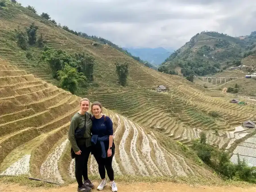
Y Linh Ho's defining feature is rice terraces on steep slopes — among the most panoramic in Muong Hoa Valley. From paths above and through the village, fields stack toward the river corridor in curves that define Sapa's international image, yet each wall represents generations of embankment maintenance and water management.
Rice terraces as livelihood
These rice terraces are farmland first. Planting season floods paddies with mirror-bright water; green season covers walls with young shoots; golden harvest transforms slopes before threshing and drying grain near homes. Shortcutting across planted fields, dislodging stones from embankments, or disturbing irrigation channels damages household income directly — especially where slopes are steeper and repair harder than on lower valley benches. Valley-wide context: Sapa Rice Terraces.
Streams and water
Small streams feed terrace irrigation and domestic use — side channels connecting to the Muong Hoa river system downstream. Water availability governs planting timing; dry spells and heavy rain both stress embankments differently. Seasonal stream volume affects path conditions on side routes — slick mud after rain, exposed stone in dry months.
Views and atmosphere
Upper elevation produces wide horizon views on clear mornings — toward the Hoang Lien skyline and Fansipan massif when cloud lifts. Afternoon mist often rises from the valley floor below Lao Chai, swallowing terraces incrementally. That variability is atmospheric for photography but requires patience and realistic expectations about summit visibility.
Traditional Houses and Daily Life
Black Hmong homes in Y Linh Ho follow the wooden hillside pattern common across upper Muong Hoa — post-and-beam frames, metal or tile roofs, central cooking fires, and livestock kept adjacent to living quarters. Dispersed ridge-line placement means village life unfolds along paths between houses rather than around a single plaza.
Daily rhythm follows agricultural cycles: early field work, animal feeding, school departures on foot, textile work in afternoons, early evenings around kitchen fires. Tourism passes through on trekking schedules — guides leading groups, occasional craft encounters on paths — without replacing farming as the economic foundation for most households.
Children walk significant distances to schools; elders maintain indigo dyeing, weaving, and oral histories. Younger adults may guide treks or work in town, sending income back while reducing village labour for terrace repair.
Visitors who accept brief tea encounters or guided cultural explanation engage hospitality traditions; visitors who treat porch scenes as open photography sets without asking breach trust quickly — even in a village quieter than Lao Chai.
Agriculture and Livelihoods
Y Linh Ho livelihoods centre on terrace rice cultivation supplemented by corn, vegetables, and livestock on steeper margins. Buffalo plough fields where mechanisation cannot reach; pigs and poultry provide protein and market sales. Indigo and hemp textile production adds household income and clothing identity — cloth drying on lines visible from trekking paths on dry days.
Tourism income flows through guiding, occasional homestay hosting on multi-day routes, and direct craft sales — unevenly distributed among households on main paths versus quiet side ridges. Private trekking with local guides who employ valley families directly supports more equitable benefit than anonymous mass tourism.
Upper-valley agriculture faces shorter growing seasons and higher erosion risk than Ta Van's lower benches — terrace repair after landslides is constant work. Interpreting Y Linh Ho through farming reality prevents treating panoramic terraces as static scenery.
Culture and Traditions
Black Hmong culture in Y Linh Ho expresses through indigo dyeing, hemp weaving, embroidered detail on festival garments, and spiritual practice centred on ancestors and household altars. Daily work clothes differ from ceremonial dress; the indigo tradition that names the Black Hmong subgroup is visible in cloth production rather than only in market performance.
New Year, wedding, and funeral protocols follow calendars and negotiations familiar across Hmong communities in the region — generally private unless hosts explicitly invite outside observation. Spirit beliefs attach to landscape features and domestic space; intrusive photography during preparation causes offence.
Market trips to Sapa Town connect Y Linh Ho to the wider economy — textiles, produce, and purchased goods carried uphill on return paths. Cultural learning on a valley trek happens most authentically through guided conversation and observation of daily work rather than staged demonstrations.
Compare downstream cultural shifts as you walk: Giay stilt houses and riverside rhythm at Ta Van; Red Dao embroidery and forest medicine toward Giang Ta Chai — each chapter distinct within one valley day.
Best Seasons to Visit
Y Linh Ho rewards visitors across seasons, with terrace appearance and path conditions shifting through the monsoon calendar.
Spring (March–May)
Green terraces and comfortable walking; occasional rain. Clear mornings improve after winter mist — strong period for panoramic photography above steep walls.
Summer (June–August)
Emerald slopes; wettest months with slick paths and frequent cloud. Lush atmosphere when mist clears briefly; waterproof footwear essential on upper gradients.
Autumn (September–November)
Golden rice before harvest; clearer skies — widely considered the finest period for terrace colour and Hoang Lien views from upper paths.
Winter (November–February)
Cold mist; quieter trails; terraces may lie fallow. Dramatic cloud inversions on sharp cold mornings; warm layers essential at upper elevation.
Mountain weather shifts hour by hour. Trust your guide's daily assessment over town-level forecast apps.
Responsible Tourism
Y Linh Ho receives less concentrated foot traffic than Lao Chai but remains on daily trekking schedules — especially as the first village on the Easy Muong Hoa Valley Trek and other valley products.
Responsible practices:
- •Stay on established paths — do not cut across planted terraces
- •Ask permission before photographing people, especially women at textile work and children on school paths
- •Buy crafts directly from makers; avoid aggressive bargaining on handmade embroidery and cloth
- •Carry out all litter; do not give candy or money to children on trails
- •Walk at village pace near houses; reduce noise around livestock
- •Book private tours with local guides employed directly
Compare norms with downstream village guides — Lao Chai Village, Ta Van Village, Giang Ta Chai Village — as ethnic context and trail conditions change through the day.
Sapa Local Guides operates with a minimum of two paying travellers. Custom routes and extended valley combinations are available through Private Sapa Expeditions.
Practical Visitor Information
How trekkers typically reach Y Linh Ho
Most visitors arrive descending from upper trailheads above the village — the opening section of the Easy Muong Hoa Valley Trek and other Muong Hoa day routes. Sapa Local Guides requires a minimum of two paying travellers; meeting point is typically Sapa Stone Church on Fan Si Pan Road before transfer to the walk start.
Y Linh Ho is usually the first named village on a valley descent — followed by Lao Chai, Ta Van, and optionally Giang Ta Chai on longer routes. The Complete Sapa Travel Guide compares products without duplicating every trail segment here.
What to bring
Waterproof footwear, rain layers, sun protection, and a modest day pack suit upper-valley walking year-round. Upper paths stay muddy for days after rain. Cash supports direct craft purchases where card payment is unavailable.
Fitness and timing
Reaching Y Linh Ho involves sustained descent from rim trailheads — moderate fitness suffices with guide support. Arriving early in the day, as private tours typically schedule, improves light for terrace photography and reduces overlap with later groups at downstream villages.
Continuing downhill
The village chain continues through Lao Chai toward Ta Van and Giang Ta Chai — each with dedicated entity pages linking back to Y Linh Ho as the upper anchor. Multi-day and custom itineraries extend further south through Private Sapa Expeditions.
Frequently Asked Questions
What is Y Linh Ho known for?
Y Linh Ho is known for steep panoramic rice terraces, its upper-valley Black Hmong community, and its role as the first major village on many Muong Hoa trekking descents from Sapa.
Is Y Linh Ho the same as Muong Hoa Valley?
No. Muong Hoa Valley is the entire river corridor; Y Linh Ho is one village within it — the upper Black Hmong terrace anchor opening the standard trekking sequence.
Which ethnic group lives in Y Linh Ho?
Y Linh Ho is predominantly Black Hmong. Lao Chai downstream shares similar identity; Ta Van introduces Giay communities; Giang Ta Chai is primarily Red Dao.
How far is Y Linh Ho from Sapa Town?
Y Linh Ho is reachable on foot within the first one to two hours of a typical valley descent from upper trailheads — after short road transfer from town. It is not adjacent to Sapa centre.
Is Y Linh Ho on the Easy Trek route?
Yes. Y Linh Ho is a regular feature of the Easy Muong Hoa Valley Trek — a private full-day route through upper Muong Hoa villages with local English-speaking guides.
When is the best time to photograph terraces?
September through November often offers golden rice and clearer skies; March through May provides green terraces with manageable rain. Summer is lush but cloudy; winter is atmospheric but may hide distant peaks.
How does Y Linh Ho relate to Fansipan?
Y Linh Ho sits on Hoang Lien foothills below Fansipan — upper terrace country with summit peaks occasionally visible from paths on clear days. Valley trekking and Fansipan summit visits require separate planning; see the Fansipan guide.
Is Y Linh Ho less crowded than Lao Chai?
Generally yes — Y Linh Ho's dispersed layout and upper position attract less concentrated stall traffic than Lao Chai crossroads, though daily trekking groups still pass through. Early starts reduce overlap with other groups downstream.
Y Linh Ho opens the Muong Hoa story at its highest terrace drama — indigo cloth on porches, buffalo on steep walls, cloud moving through fields that families have farmed for generations. Walk through knowing the names that follow downstream, and the valley becomes a connected place rather than a single photograph from above. Plan gear for upper-valley cold and mud via What to Pack for Sapa. Season planning: Best Time to Visit Sapa · September & October Harvest Season in Sapa · Wet Season & Fog Season in Sapa. Valley authority: Muong Hoa Valley.
Compare bookable routes: Y Linh Ho tours.
Want to create your own story?
Join a Sapa trek or homestay and live the real mountains.
Enquire on WhatsApp